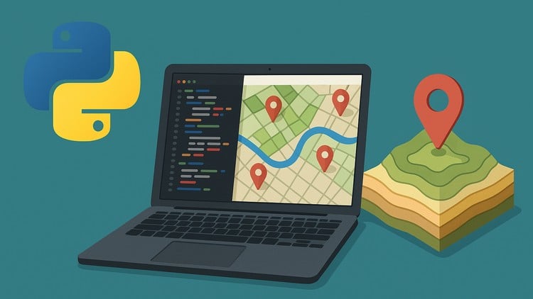
“Automate GIS Workflows and Build Real-World Geospatial Projects with ArcPy, PyQGIS, and Python.
⏱️ Length: 5.2 total hours
⭐ 4.31/5 rating
👥 5,280 students
🔄 October 2025 update
Add-On Information:
Note➛ Make sure your 𝐔𝐝𝐞𝐦𝐲 cart has only this course you're going to enroll it now, Remove all other courses from the 𝐔𝐝𝐞𝐦𝐲 cart before Enrolling!
- Course Overview
- This intensive course is meticulously designed to bridge the gap between traditional GIS operations and modern programming efficiency, empowering geospatial professionals and enthusiasts alike.
- It offers a comprehensive dive into leveraging Python as the cornerstone for automating repetitive Geographic Information System tasks and developing sophisticated geospatial applications.
- Participants will gain a robust understanding of how Python acts as the glue connecting various GIS functionalities, from data acquisition and manipulation to complex spatial analysis and visualization, transcending manual click-and-point operations.
- The curriculum emphasizes a practical, hands-on approach, ensuring learners not only grasp theoretical concepts but also apply them immediately through engaging, real-world scenarios.
- It’s an indispensable resource for anyone looking to supercharge their GIS capabilities and embrace a future-proof skill set in the evolving landscape of geospatial technology.
- Embark on a journey to transform your geospatial workflows, making them more robust, reproducible, and significantly faster than ever before.
- Requirements / Prerequisites
- While a foundational understanding of GIS concepts, such as layers, coordinate systems, projections, and common spatial analysis types, will be highly beneficial, the course structure is designed to guide learners progressively.
- A working knowledge of basic Python syntax, including variables, data types, control structures (loops, conditionals), and function definitions, is strongly recommended to maximize learning outcomes and keep pace with the coding exercises.
- Familiarity with object-oriented programming (OOP) principles is helpful but not strictly required.
- Access to either Esri’s ArcGIS Pro/ArcMap or the open-source QGIS software is essential for following along with the practical demonstrations and executing the project-based assignments, as the course specifically covers aspects of both ArcPy and PyQGIS.
- No prior experience with GIS automation or advanced programming concepts is necessary; the course begins with the fundamentals of scripting for geospatial contexts and builds expertise from there.
- A willingness to experiment with code, debug issues, and engage actively with the course material is paramount for transforming theoretical knowledge into practical, deployable skills.
- Skills Covered / Tools Used
- Beyond the stated learning objectives, this course will hone your ability to write clean, maintainable, and efficient Python scripts tailored for diverse geospatial challenges.
- You will develop expertise in interacting with the file system and external programs through Python’s
os,sys, andsubprocessmodules, crucial for managing geospatial project environments. - Gain proficiency in handling various geospatial data formats (shapefiles, GeoTIFFs, KML, GeoJSON) programmatically using specialized libraries like
geopandas,fiona, andrasterio, enabling seamless data ingestion and export. - Explore advanced spatial data manipulation techniques, including geometric operations (buffering, intersection, union), reprojection, and spatial joins, all performed with Python code.
- Learn best practices for script modularization, error handling (try-except blocks), and logging, ensuring your automation scripts are robust, easy to debug, and maintain.
- Master advanced data visualization techniques beyond basic plotting, utilizing libraries like
matplotlibandseabornto create compelling and informative maps and charts directly from geospatial data. - Understand how to integrate scientific computing libraries such as
SciPywith geospatial data for more advanced analytical tasks, including interpolation or statistical surface modeling. - Develop skills in environment management and package installation using tools like
condaorpip, essential for setting up dedicated Python environments for your geospatial projects. - Familiarization with popular Integrated Development Environments (IDEs) like VS Code or Jupyter Notebooks for an enhanced coding experience, facilitating script development, testing, and debugging.
- Implement version control best practices for your scripts, fostering collaborative development and ensuring project history and integrity.
- Benefits / Outcomes
- Elevate your professional profile by acquiring highly sought-after skills in geospatial programming, opening doors to advanced roles in GIS development, data science, and environmental analysis.
- Significantly boost your productivity and efficiency in daily GIS tasks by transforming tedious, repetitive manual processes into lightning-fast, automated scripts.
- Cultivate a strong problem-solving mindset, empowering you to approach complex spatial challenges not just with GIS software, but with custom-tailored programmatic solutions.
- Build a robust portfolio of real-world geospatial automation projects, demonstrating tangible skills to potential employers and collaborators.
- Gain the confidence to independently tackle large-scale geospatial datasets and intricate analytical workflows that would be cumbersome or impossible with manual methods.
- Develop a deeper, more conceptual understanding of how GIS software functions under the hood, enabling you to troubleshoot issues more effectively and innovate new solutions.
- Position yourself at the forefront of geospatial innovation, ready to adapt to new technologies and contribute to the rapidly evolving fields of smart cities, remote sensing, and location intelligence.
- Join a growing community of GIS developers, capable of contributing to open-source projects and collaborating on advanced geospatial research and applications.
- Future-proof your career by becoming proficient in a skill set that is increasingly critical across all sectors utilizing location intelligence.
- PROS
- Comprehensive coverage of both industry-standard (ArcPy) and open-source (PyQGIS) GIS automation frameworks, maximizing versatility for diverse professional environments.
- Emphasizes practical, project-based learning, allowing students to immediately apply concepts and build a tangible portfolio.
- Strong focus on developing efficient and scalable solutions for real-world geospatial challenges, moving beyond theoretical knowledge.
- Updated content (October 2025 update) ensures relevance with the latest software versions and best practices in the field.
- Taught by an experienced instructor, as indicated by a high rating and significant student enrollment, ensuring quality and pedagogical effectiveness.
- Flexibility to learn at your own pace, with accessible content suitable for review and reference long after initial completion.
- CONS
- Requires dedication to practice and self-study for complete mastery, as the condensed duration necessitates significant individual effort to fully internalize the concepts and techniques presented.
Learning Tracks: English,Development,Programming Languages